(click to enlarge)
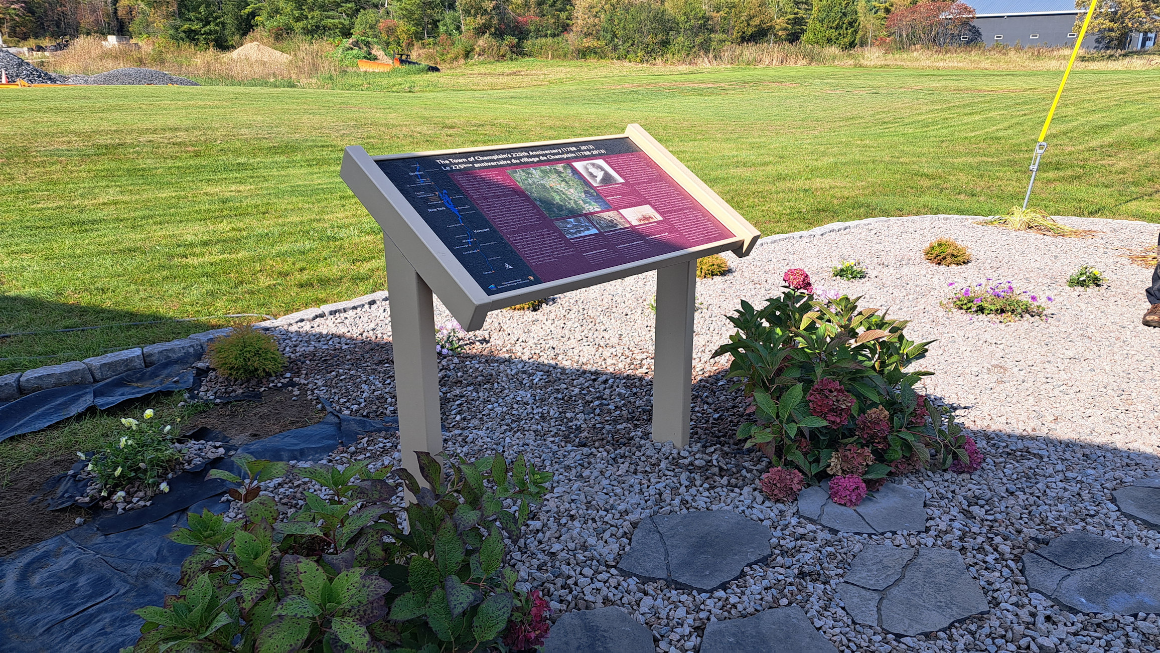
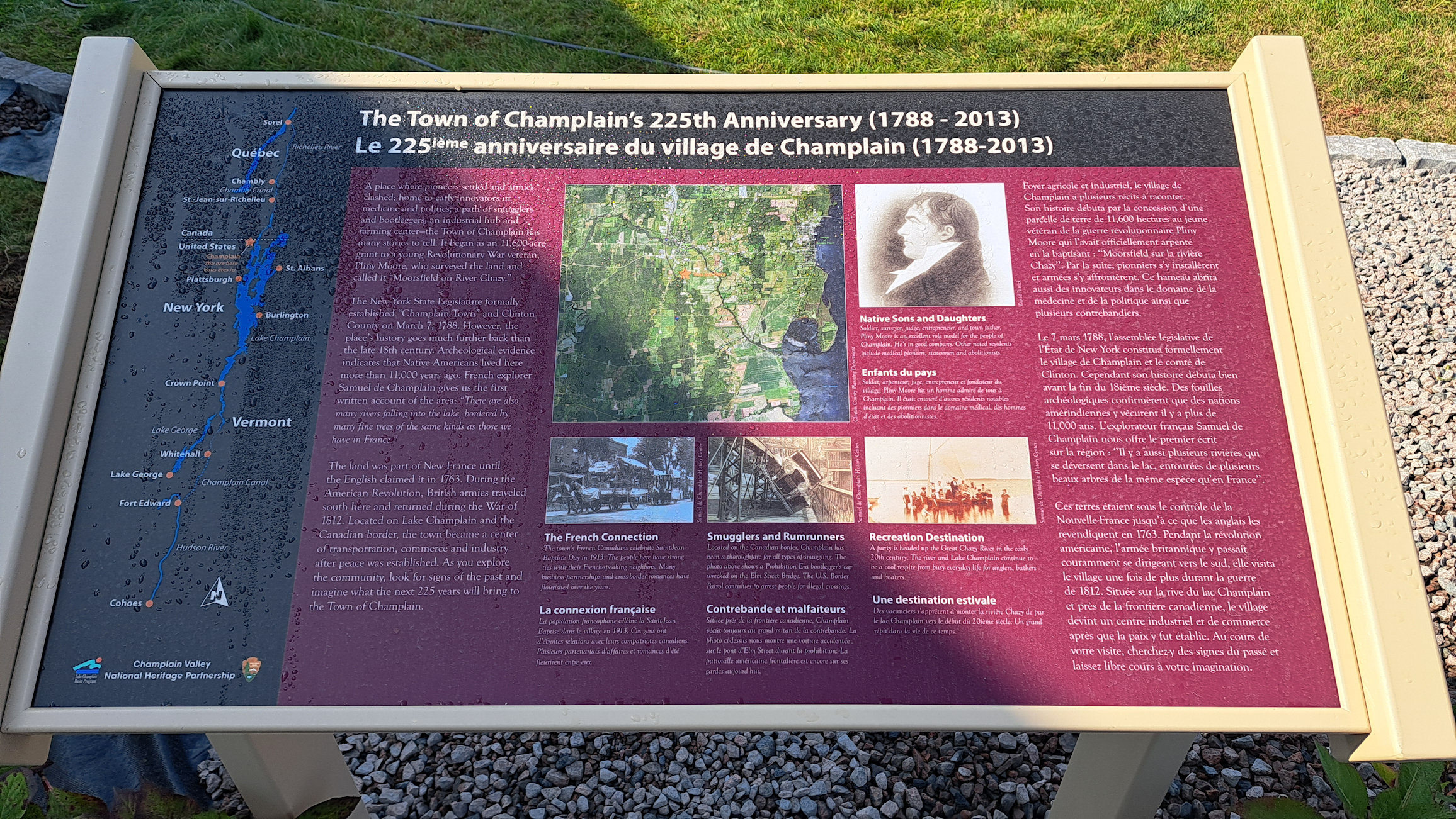
The Town of Champlain's 225th Anniversary (1788 - 2013)
GPS Location: 44.95867553290001,
-73.44294690383417
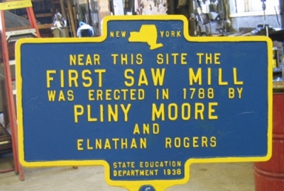
During the Revolutionary War, the State of
Shortly before Pliny
Moore moved to the area, he encouraged
the state legislature to divide
The State of
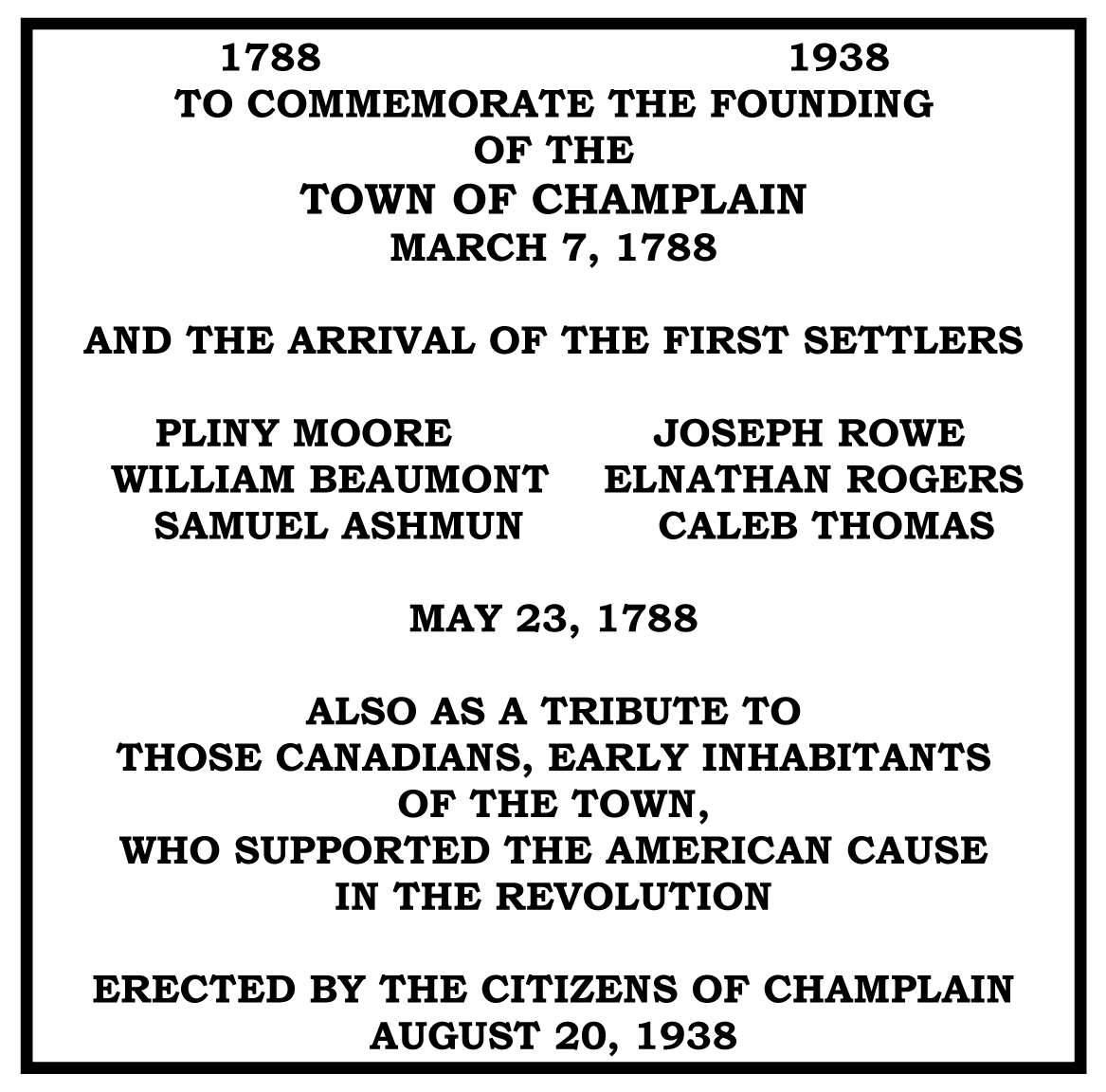
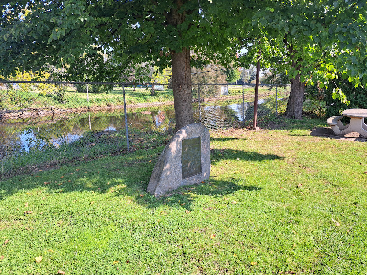
1938 Plaque
GPS Location: 44.98644768558771,
-73.44583643634374
(click to enlarge)
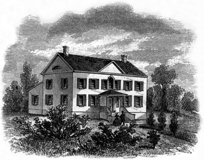
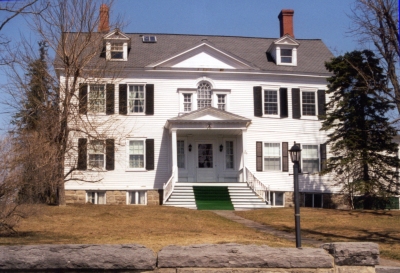
The Pliny Moore House,
Village of Champlain
GPS Location: 44.98674448288278, -73.44518258545456
Caption on
the panel:
In 1789,
Revolutionary War veteran Pliny Moore (1759-1822)
settled Champlain after being awarded land by the
State of
During the War of
1812, the border became a revolving door for the
American and British armies and militias.
In November of
1812, American General Henry Dearborn used
In October of
1813, British Major J. Perreault threatened Moore and
the village inhabitants after an attack at the border. His troops
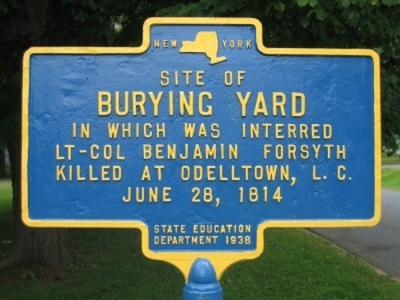
later pillaged the village. In June of
1814, Colonel Benjamin Forsyth was killed on the road
to Lacolle (NY Rt. 276).
Two months later, his death was avenged by the
ambush of British Captain St.
Valier Mailloux (Mahew) who had commanded the
militia and Indians who killed Forsyth. Mailloux
died in the basement of
The Washington,
D.C. based newspaper, Niles Weekly Register, published
news on the war. In October of 1813, the paper
published a public threat made to Judge Pliny Moore by
Canadian militia commander J. Perreault
A British major. — The
following gasconading notice was sent out to judge
LA COLE, 10th October.
“Citizens of Champlain! — I am happy
that humanity should still have so much power over me so
as to inform you that should any of the militia of
Champlain, be found hovering this side of the line, I
will let loose upon your village and inhabitants, the
Canadian and indian force under my command. But
your cowardly attack at midnight, of a small picket of
ours, has torn asunder the veil which hid you from
them — So beware!
J. PERREAULT,
major commanding ad. post.
You
are probably aware that it has been with greatest
difficulty I have till now withheld them.
“P. S. Major Perreault would be obliged to the honorable
judge Moore,
to acquaint the citizens of Champlain of the tenor of
the above humane advertisement.
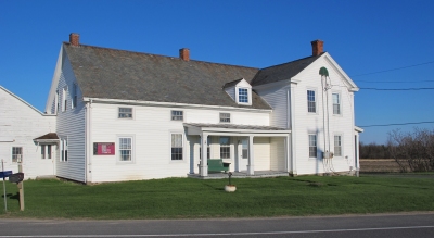
Pliny Moore’s house is shown in an
1829 painting on the interpretive panel. The house
burned down on April 27, 1912 and was rebuilt in 1913 to
the same exterior specifications. The McLellan
family lived in the house from 1883 to 1983 and were
descendants of Pliny Moore. The original
watercolor painting on the interpretive panel is from
the collections of the
(click to enlarge)
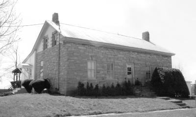
The Pliny
Moore Stone Farm House, Village of Champlain
(War of 1812)
GPS
Location: 44.988542419754076, -73.44069284558442
Caption
on the panel:
In 1808, Pliny Moore built a stone farm house on the Great Northern Turnpike (part of today’s Prospect Street). Today, this is the oldest house in the village.
At the outbreak of the War of 1812, the citizens of Champlain were uneasy about incursions from Canada. A Committee of Safety persuaded the army to build two blockhouses in nearby fields. The structures were used by visiting New York and Vermont militia.
In the summer of 1813, British Colonel John Murray burned public property in Burlington, Plattsburgh, Swanton, Chazy and Champlain in what was called “Murray’s Raid”. On the way back to Canada, a detachment of Murray’s troops rowed up the Great Chazy River and burned the two blockhouses.
The armies of American General Henry Dearborn and James Wilkinson camped nearby. During the summer of 1814, militia skirmished at the top of the hill, in the fields off upper Prospect Street as well as along the road to Lacolle, Quebec (NY Route 276) north of Dewey’s Tavern.
In September of 1814, half of British General George Prevost’s army camped nearby and used the unoccupied house as a commissary. It took this half of the army 12 hours to march down this road and over the Great Chazy River bridge on their way to Plattsburgh.
The stone farm
house was given to Pliny’s daughter Matilda who
married Rev. Abraham Brinkerhoff. By the 1840s, the
house and farm were owned by Freeman and Bartlett Nye.
Donat Guay owned the farm in the early 1900s and
sold it to the Racine family in 1942. In August of
1938, a NYS historic marker was dedicated by Oscar
Bredenberg during Champlain Town’s 150th
Anniversary.
North
Countryman Newspaper Article
(click to enlarge)
(War of 1812)
GPS
Location: 44.988649229666045,
-73.41307018841651
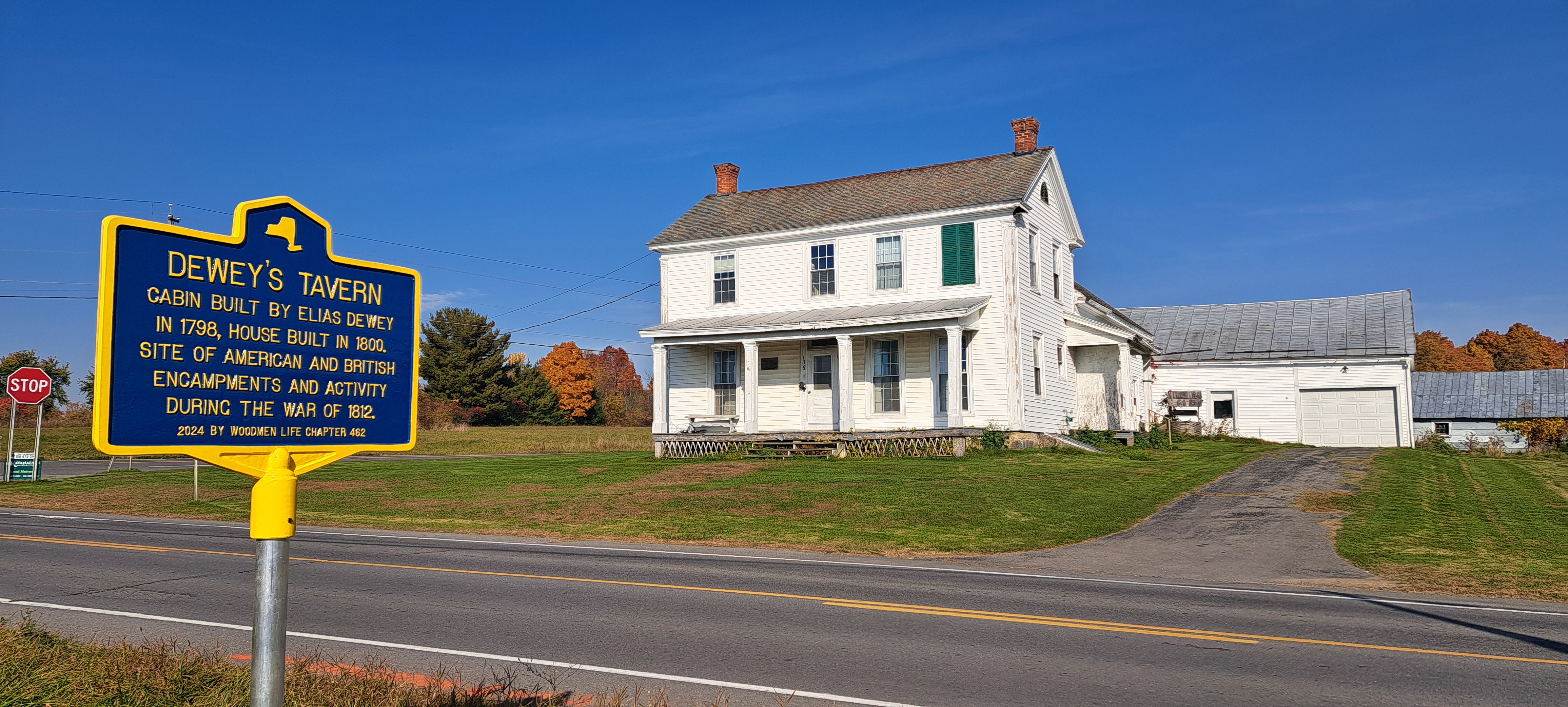
Caption on the
panel:
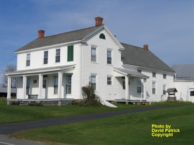
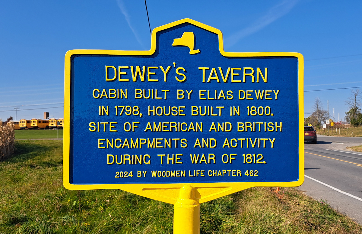
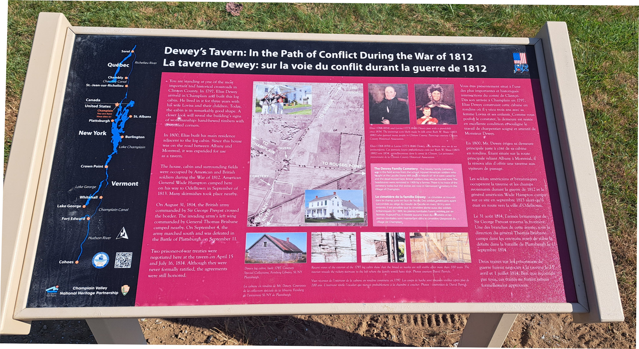
You are standing at one of the most important and
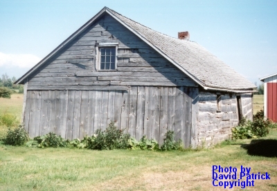
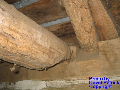
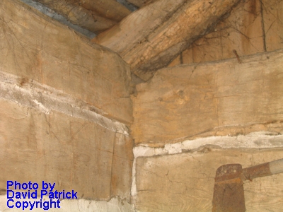
historical crossroads in Clinton County. In 1797,
Elias Dewey arrived in Champlain and built this log
cabin. He lived in it for three years with his
wife Lovisa and their children. Today, the cabin
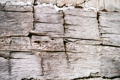
is in remarkably good shape. A closer look will
reveal the building’s signs of workmanship: hand-hewed
timbers with dovetailed corners.
In 1800, Elias built his main residence adjacent to the log cabin. Since this house was on the road between Albany and Montreal, it was expanded for use as a tavern.
The house, cabin and surrounding fields were occupied by American and British soldiers during the War of 1812. American General Wade Hampton camped here on his way to Odelltown in September of 1813. Many skirmishes took place nearby.
On August 31, 1814, the British army commanded by Sir George Prevost crossed the border. The invading army’s left wing commanded by General Thomas Brisbane camped nearby. On September 4, the army marched south and was defeated in the Battle of Plattsburgh on September 11.
Two prisoner-of-war treaties were negotiated here at the tavern on April 15 and July 16, 1814. Although they were never formally ratified, the agreements were still honored.
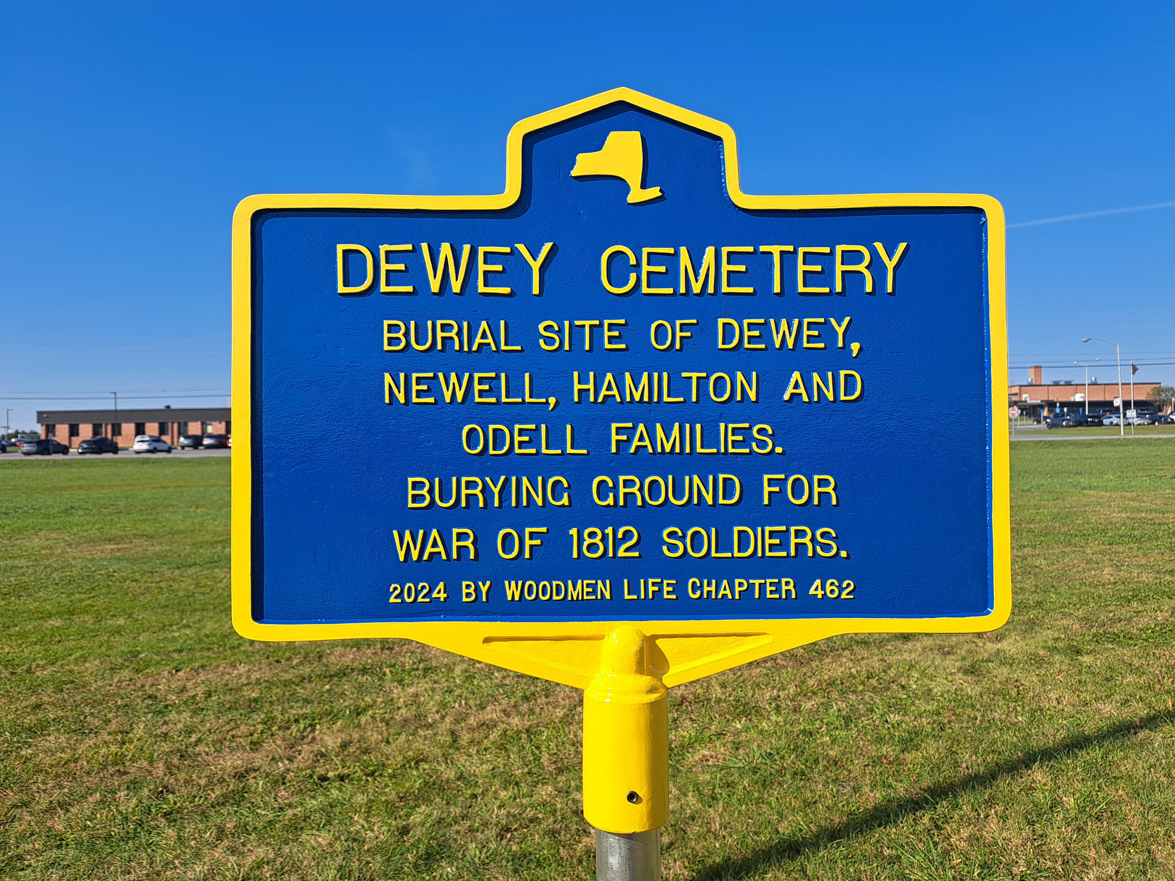
The Dewey Family Cemetery was in the field across from the school. Injured American soldiers who fought at the Lacolle Stone Mill siege in March of 1814 were cared for and the dead buried here. British soldiers may also be buried here. The headstones were removed in 1909 by a farmer. There is no trace of the cemetery today but the stones are now in Glenwood Cemetery in the Village of Champlain.
Elias (1768-1854) and Lovisa (1773-1846) Dewey pose with a grandchild circa 1834. The paintings were likely made by folk artist Ruth W. Shute (1803-1882) who painted many people in Clinton County. Paintings courtesy Clinton County Historical Association.
Recent views of the
exterior of the 1797 log cabin show that the broad ax
marks are still visible after more than 200 years.
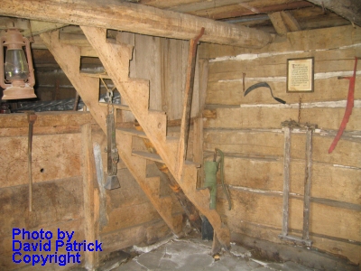
The interior reveals the rickety staircase to the loft
where the family would have slept. Photos courtesy
David Patrick.
(click to enlarge)
GPS Location: 44.988649229666045, -73.41307018841651
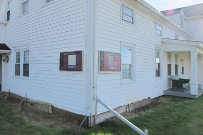
(Two panels now in town park across the street)
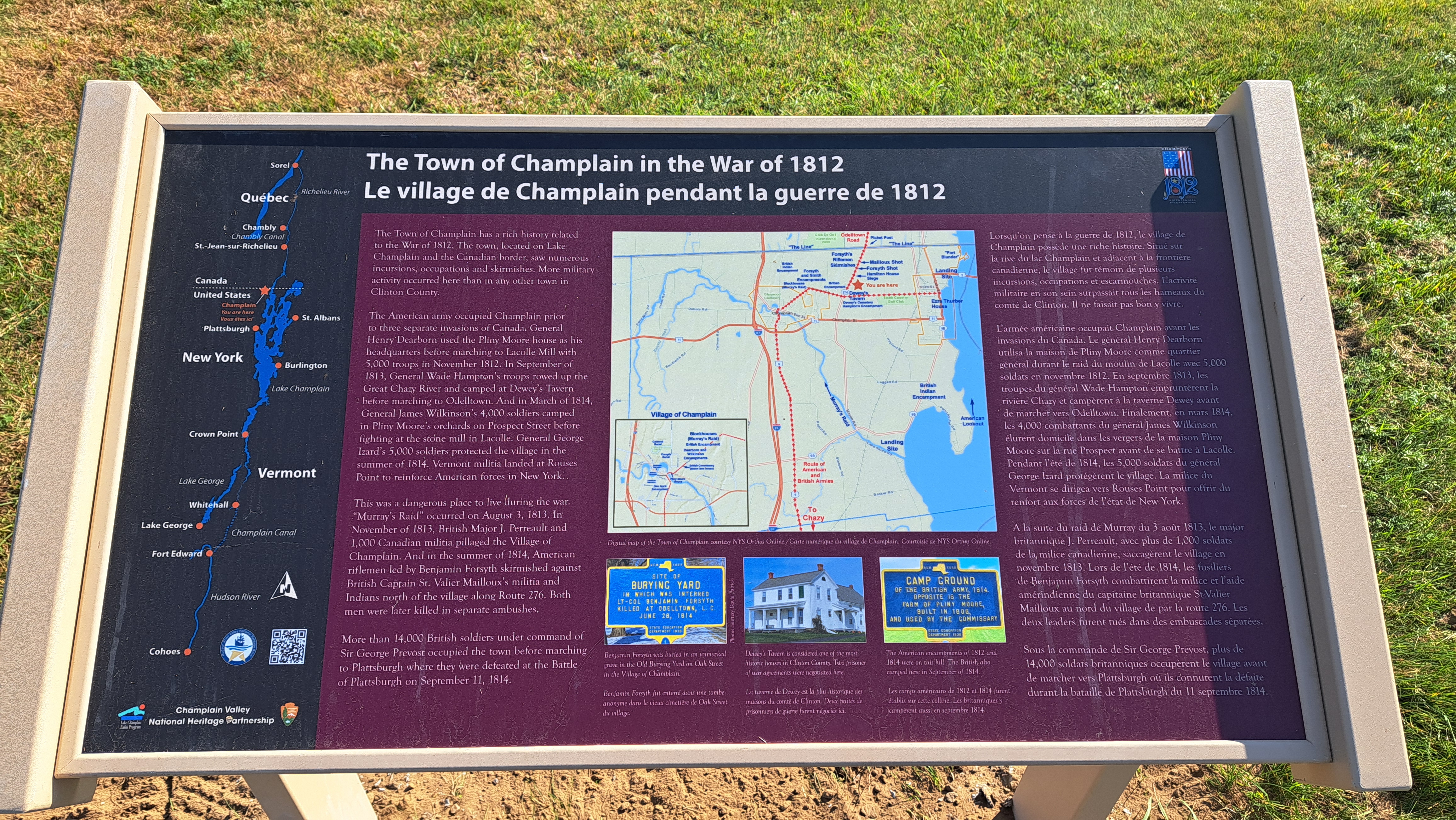
Caption on the panel:
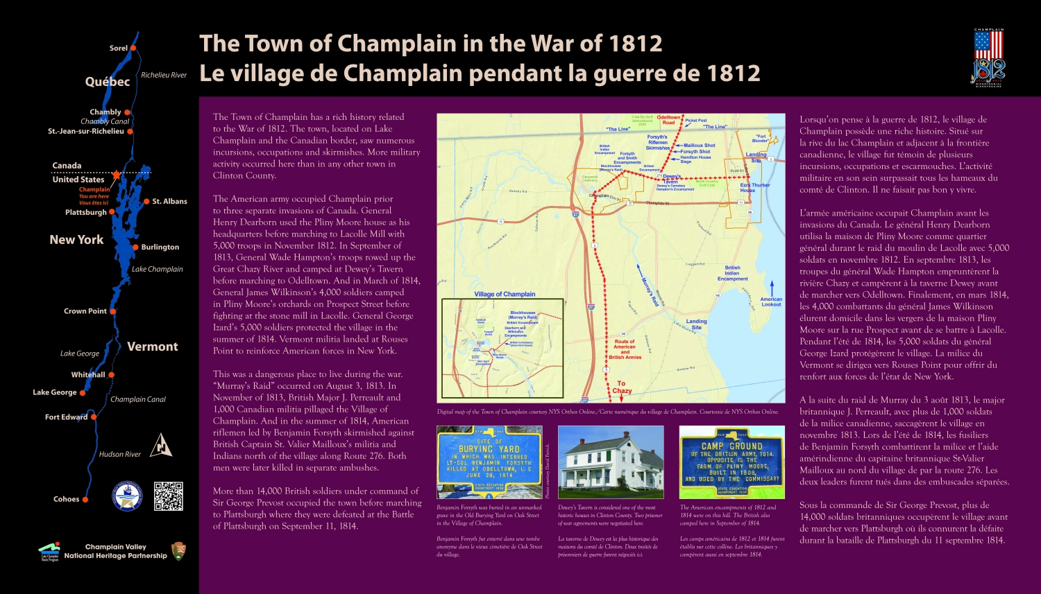
The Town of Champlain has a rich history related to the War of 1812. As a town bordering Canada and Lake Champlain, it saw numerous incursions, occupations and skirmishes. More military activity occurred here than in any other town in Clinton County.
The American army occupied Champlain three times before invading Canada. In November of 1812, General Henry Dearborn used the Pliny Moore house as his headquarters before marching to Lacolle Mill with 5,000 troops. In September of 1813, General Wade Hampton’s troops rowed up the Great Chazy River and camped at Dewey’s Tavern before marching to Odelltown. And in March of 1814, General James Wilkinson’s 4,000 troops camped in Pliny Moore’s orchards on Prospect Street before fighting at the stone mill in Lacolle. General George Izard’s 5,000 troops protected the village in the summer of 1814.
Many skirmishes and raids occurred around town. “Murray’s Raid” occurred on August 3, 1813. In November of 1813, British Major J. Perreault and 1,000 militia pillaged the Village of Champlain after several previous incursions. And in the summer of 1814, Lieut.-Col. Benjamin Forsyth’s Riflemen and Capt. St. Valier Mailloux’s militia and Indians had several skirmishes north of the village and along Route 276. Both men were killed in separate ambushes in June and August.
In August and September of 1814, 14,000 British soldiers under command of Sir George Prevost occupied the town before marching to Plattsburgh. After the Battle of Plattsburgh on September 11, a brigade remained until September 25.
Rouses Point was a landing site for Vermont militia crossing the lake. In 1816, the building of “Fort Blunder” was commenced on Island Point.
Click to see Interactive Maps
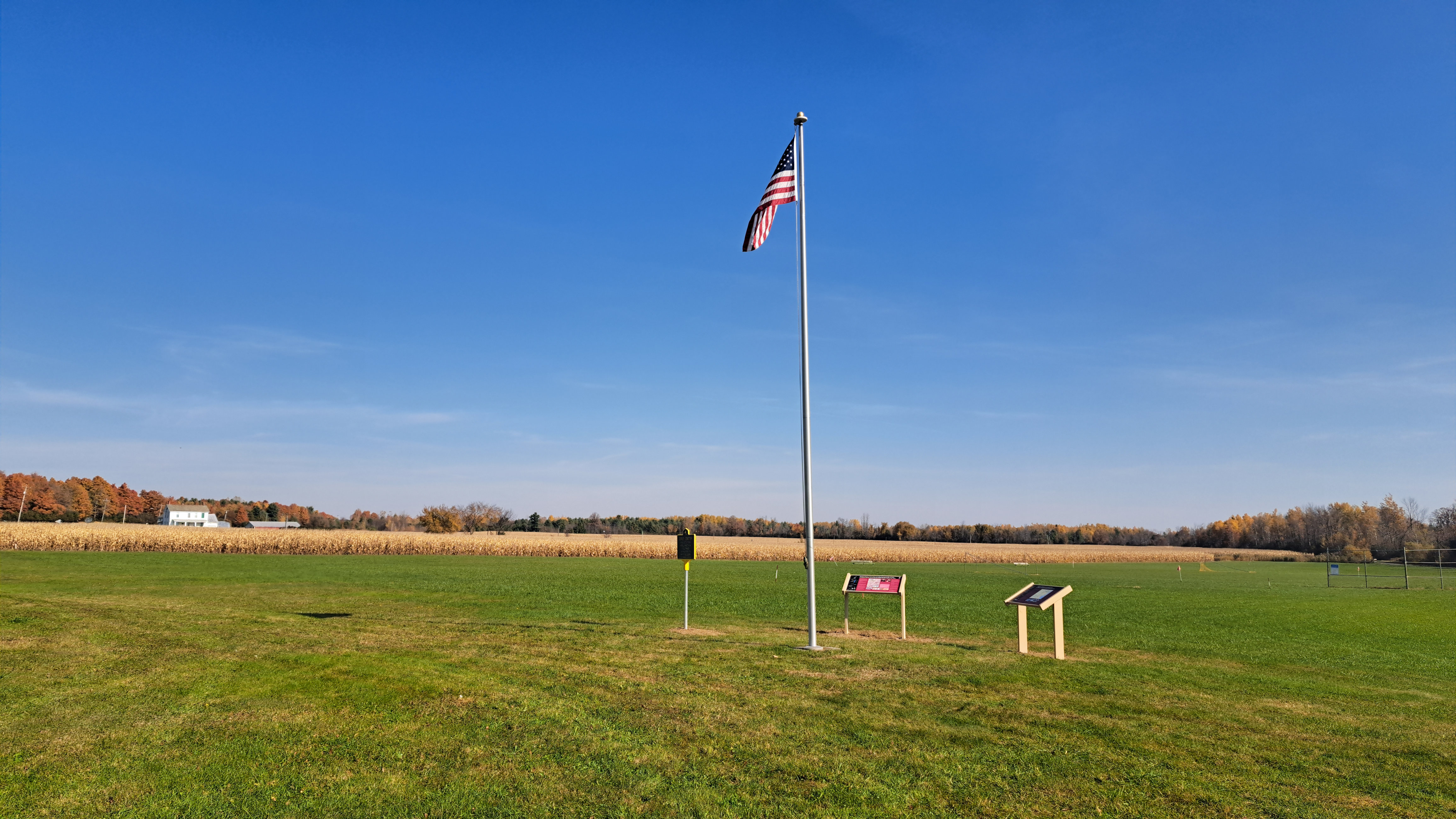
Town of Champlain Park
GPS Location: 44.988649229666045, -73.41307018841651
In October of 2024, the two interpretive panels on the back of the house of Dewey's Tavern were moved to the Town of Champlain's park and placed alongside a flagpole that had been donated a decade ago by the Woodmen of the World, local chapter 462. Two new blue and yellow historic markers were sponsored by the Woodmen chapter in 2024. One marker was placed in front of Dewey's Tavern and the second one was placed at the suspected site of a one acre family burial ground for the Dewey family. American soldiers who died in the War of 1812 are also buried here. Legend states that British soldiers who died in the Battle of Plattsburgh were also buried here but this has not been substantiated.
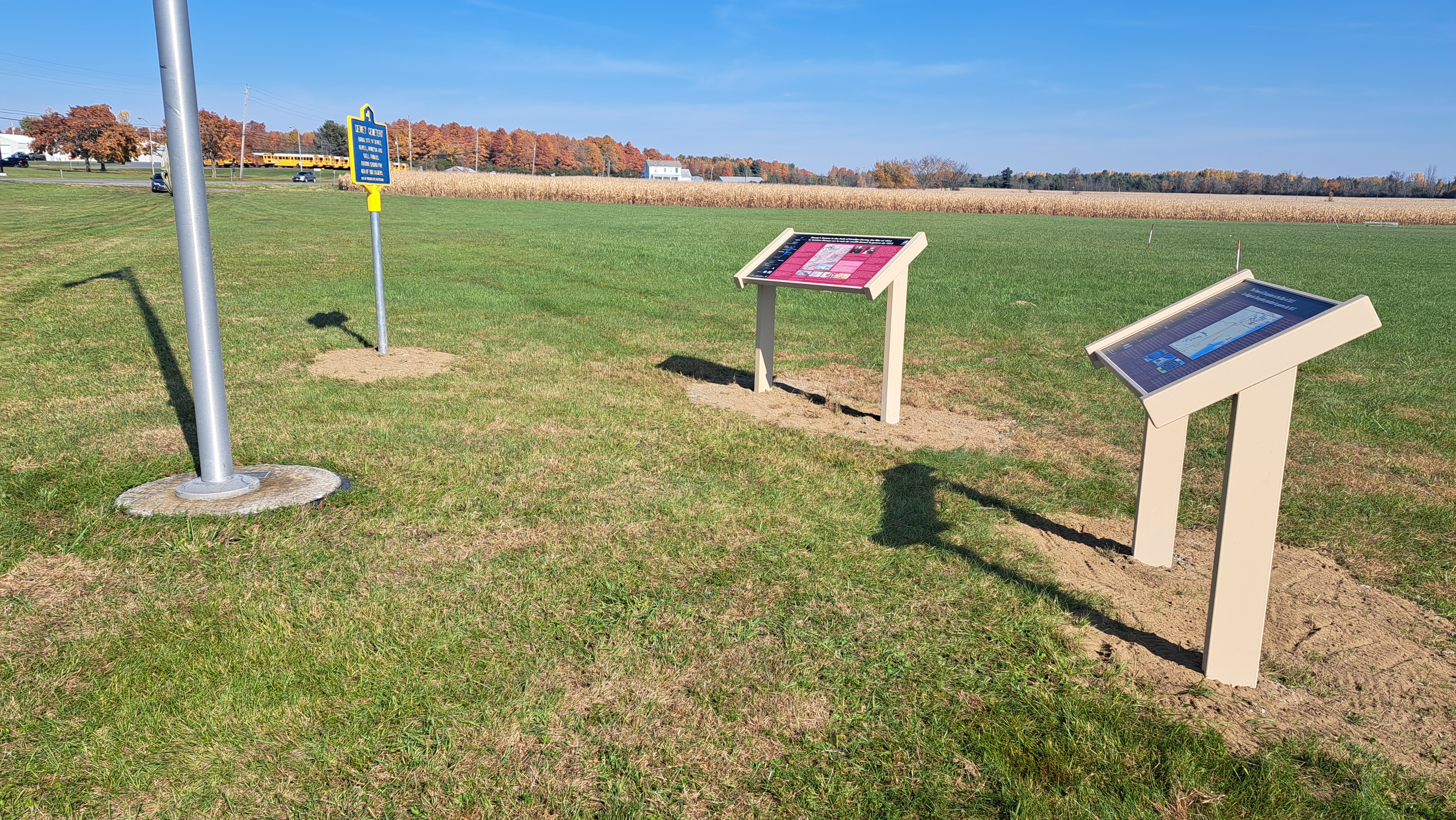
All photos copyright by David Patrick.
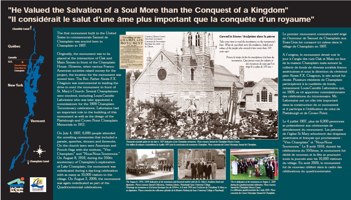
(click to enlarge)
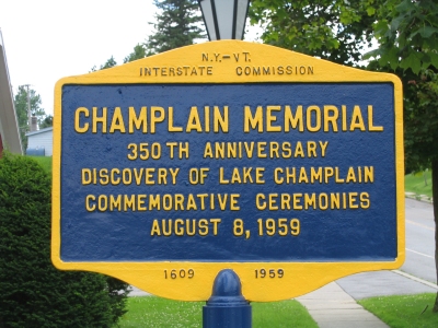
(Quadricentennial Re-Dedication in 2009)
GPS Location: 44.9852595464291, -73.44876414780157
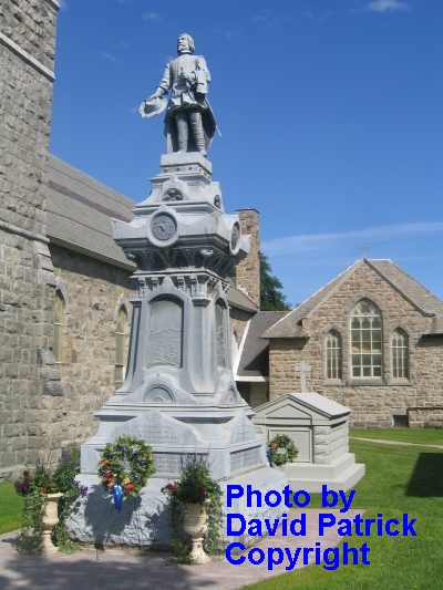
The first monument built in the United States to commemorate Samuel de Champlain was erected here in Champlain in 1907.
LE 4 JUILLET, 1907. À LA MÉMOIRE
DE
SAMUEL DE CHAMPLAIN
PAR LES FRANCO-AMÉRICANS.
SAMUEL DE CHAMPLAIN,
NÉ À BROUAGE,
DÉCOUVREUR DU LAC CHAMPLAIN, 6 JUILLET,
1609.
MORT À
HE VALUED THE SALVATION OF A SOUL MORE
THAN THE
CONQUEST OF A KINGDOM.
BEHOLD: A FERVENT CHRISTIAN; AN INTREPID
NAVIGATOR;
A MAN OF LETTERS AND THE DISCOVERER OF
THE GEM
OF THE LAKES OF
LE SALUT D’UNE ÂME VAUT PLUS QUE LA
CONQUÊTE D’UN ROYAUME.
SA MÉMOIRE EST UNE INSPIRATION QUI NOUS
PORTE VERS LE VRAI,
LE BIEN ET LE BEAU!
COMME NOTRE PATRON,
IL “PRÉPARA LES VOIES” SUR CE CONTINENT.
IL FÛT UN FERVENT CHRÉTIEN: UN INTREPIDE
NAVIGATEUR:
UN SAVANT, ET LE DÉCOUVREUR DU PLUS BEAU
LAC DE L’AMÉRIQUE.
(click to enlarge)
Point
au Fer Historic Site, Town of Champlain
(Dedicated
Memorial Day, Quadricentennial in
2009)
GPS
Location: 44.94414386966011,
-73.35242289615549
Caption on the panel:
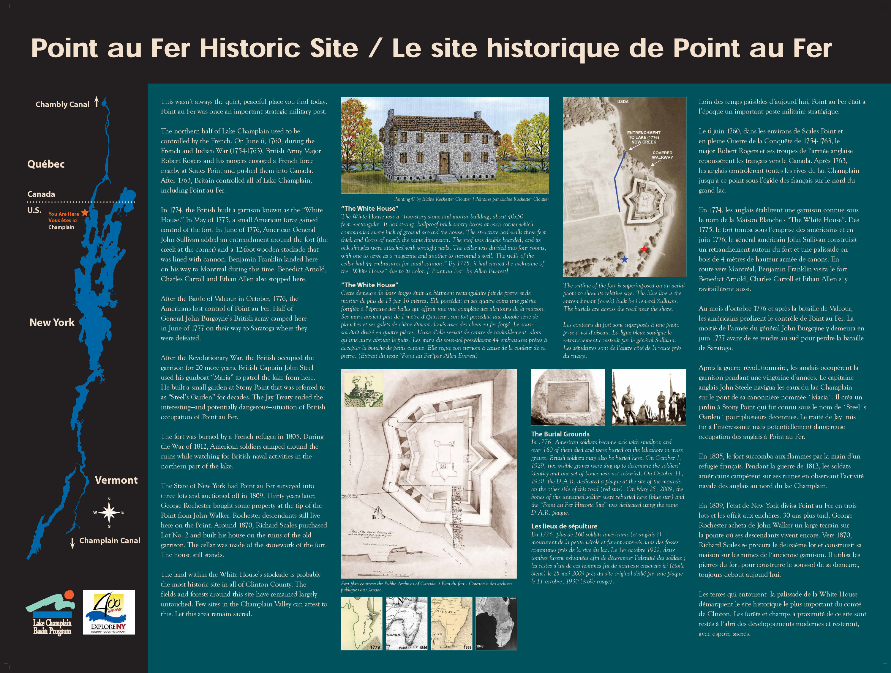
Prior to 1763, the northern half of
In 1774, the British built a garrison known as
the “White House”.
In May of 1775, a small American force gained
control of the fort and in June of 1776 American
General John Sullivan added an entrenchment around the
fort (the creek at the corner) and a 12 foot tall
wooden stockade that was lined with cannon. It was
during this time that Benjamin Franklin landed here on
his way to
After the Battle of Valcour in October of 1776,
the Americans lost control of Point au Fer. Half of
General John Burgoyne’s British army camped here in
June of 1777 on their way to
After the Revolutionary War, the British
occupied the garrison for 20 more years. British
Captain John Steel used his gunboat “Maria” to patrol
the lake off of Point au Fer. He built a
small garden at
In 1805, a French refugee burned down the fort. American
soldiers during the War of 1812 (1812-14) camped
around the ruins while watching for British naval
activities in the northern part of the lake.
In 1809, Point au Fer was surveyed into three
lots and auctioned off by the State of
The land within the White House’s stockade is
probably the most historic site in all of
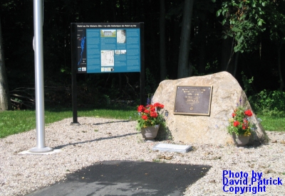
This sign is about 400 feet north of the Point au Fer Historic Site park. It stands in front of the Scales family house which was built on the ruins of the White House in the 1870s or 1880s. The land around this plaque is some of the most historic lands in the county. French, British and American soldiers camped here at different times from 1760 to 1796. The grass behind the sign is part of the enclosure of the garrison which had tall cedar posts around it at one time. The moat, now a small stream, is to the left of the sign by a few feet.
GPS Location: 44.94528350882234, -73.35262493679178
THE “WHITE
HOUSE”
IN 1774, A
TWO-STORY WHITE STONE
GARRISON
WAS BUILT HERE BY THE BRITISH,
FORTIFIED
BY AMERICAN GEN. JOHN SULLIVAN
WITH
ENTRENCHMENT AND STOCKADE IN 1776
AND
DESTROYED BY FIRE IN 1805.
BRITISH
OCCUPATION 1774-1775 AND 1776-1796.
AMERICAN
OCCUPATION MAY 1775-OCT. 1776.
ENCAMPMENT
OF THE BRITISH ARMY JUNE 1777
DURING
BURGOYNE’S CAMPAIGN TO
ALSO NEAR
HERE AT SCALES POINT WAS
FRIENDS
OF CHAMPLAIN
2009
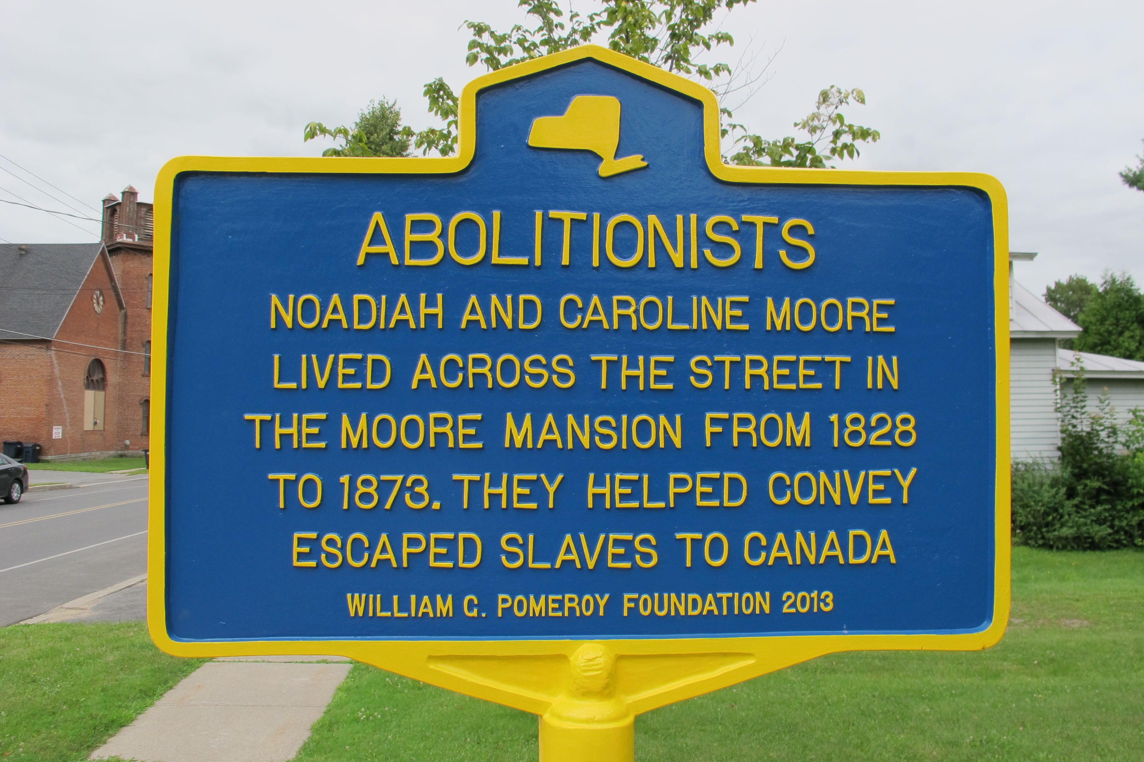
GPS Location: 44.985351366161346, -73.4487507673832
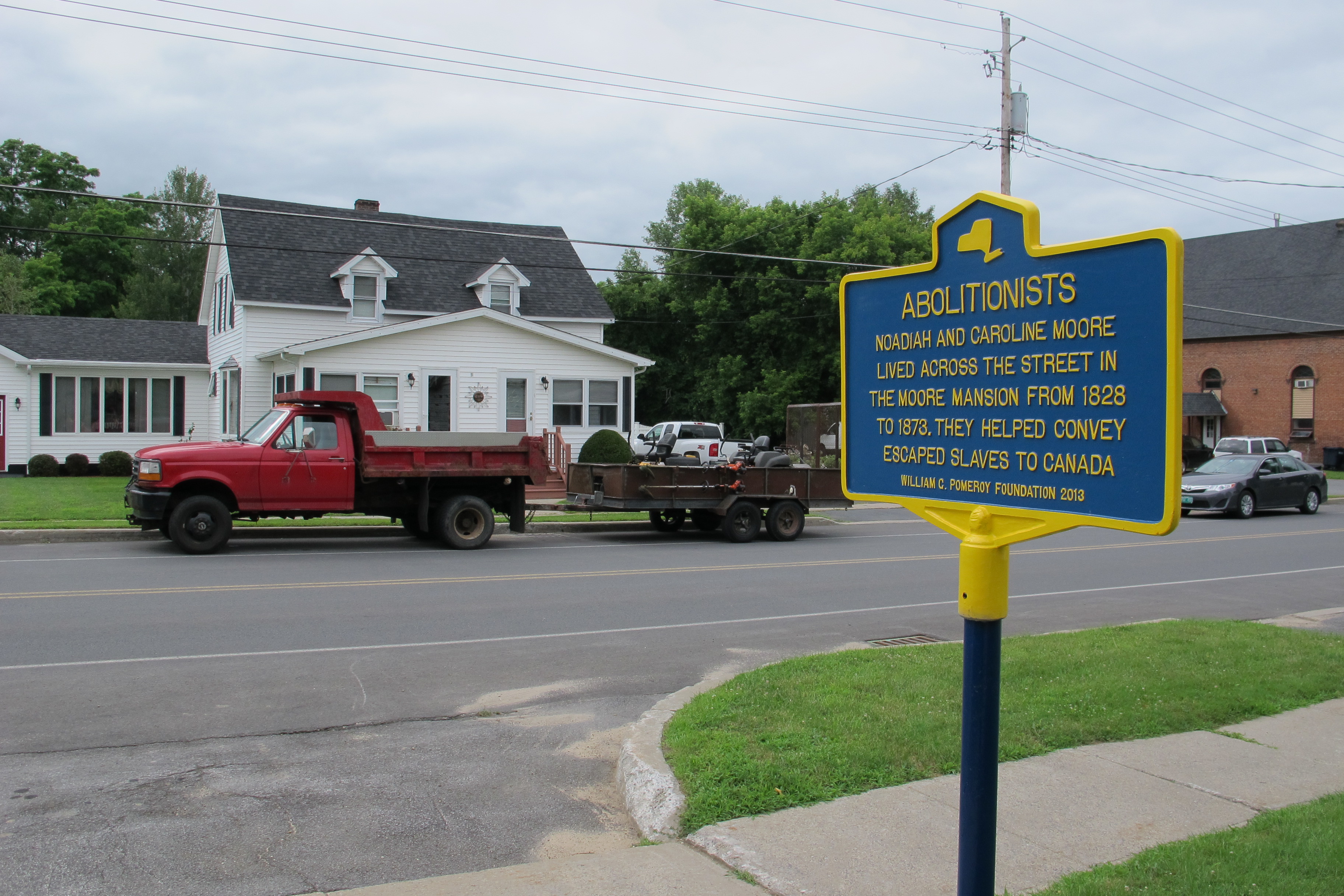
NOADIAH AND CAROLINE MOORE
LIVED ACROSS THE STREET IN
THE MOORE MANSION FROM 1828
TO 1873. THEY HELPED CONVEY
ESCAPED SLAVES TO CANADA.
WILLIAM C. POMEROY FOUNDATION 2013
Historic marker initiated by:
North Country Underground Railroad Historical Association
(not comprehensive)
GPS Location: 44.988694615892484, -73.44470831724276
GPS Location: 44.99042311398693, -73.44467302762257 GPS Location:44.99476482165542, -73.44454257947257
GPS Location: 44.9852595464291, -73.44876414780157
GPS Location: 44.994039700939794, -73.47059471831645
GPS Location: 44.947824615848916, -73.41137604133667
The above Wayside Panels in the Town of Champlain were all created by David Patrick. Final layout was done by a graphic artist. The White House blue and yellow marker also created by David.
Other wayside panels and historic markers can be found at specific points in the town that were created by other people. Six of them were dedicated in the Village of Champlain in 1938 to celebrate the town's 150th anniversary.
Wayside Panels in Clinton County related to the War of 1812 - Lake Champlain Basin Program.
All wayside panels were created with grants provided by the Lake Champlain Basin Program.
Some grants were awarded to develop panels for the War of 1812 Interpretive Trail.
Another grant was for the Quadricentennial celebrations in 2009.